Fiction as practice
loophole<< / >>broomwitch
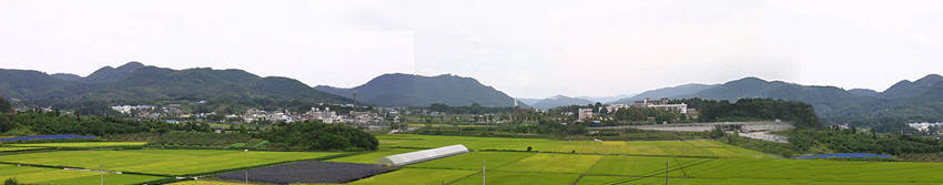
Master planning competition for administrative town in Korea / 2 000 000 m˛
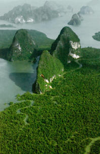
How Nature should Design a City / How City should Preserve a Nature


SWARM-TOWN is a SMART-TOWN
(an eco-software city)
Urban city planning in Korea / 2 000 000 m˛ / fall 06
R&Sie(n) / François Roche, Stéphanie Lavaux, Jean Navarro
& Benoît Durandin
& Stephan Henrich (robotic design)
& Petra Jenning, Florian von Hayek, Alain Marder-Greco, Eglantine Bigot-Doll

How Nature should Design a City / a terraforma experiment
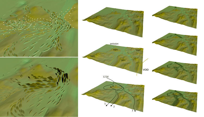
The urban morphologies, as a ‘’terraformation’’ are generated by three generative scripts.
-Flow script (as urban grid processes) Downloadsript for 3dmax7.0
-ZXY scaler script (as urban density processes) Downloadsript for 3dmax7.0
-Nerves script (as urban indoor-outdoor interface)Downloadingposponed
These three processes introduce variability and adaptability in the combination of the following datas:
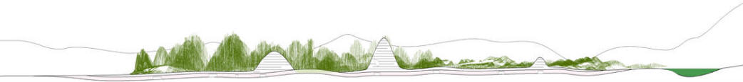
-Relief (geography and topo-morphology of the location)
-Shape (building emergences and volumetric skyline)
-Programs (as a re-reading of the generative shape, by induction-deduction-reprogramming of the volumetric iterations results)
The urban shapes resulted from scripts are directly contingent of this three parameters. The preliminary situation, the ‘’Genius Loci’’ is no more an ``green`` alibi but a vector of its transformation through urbanism.
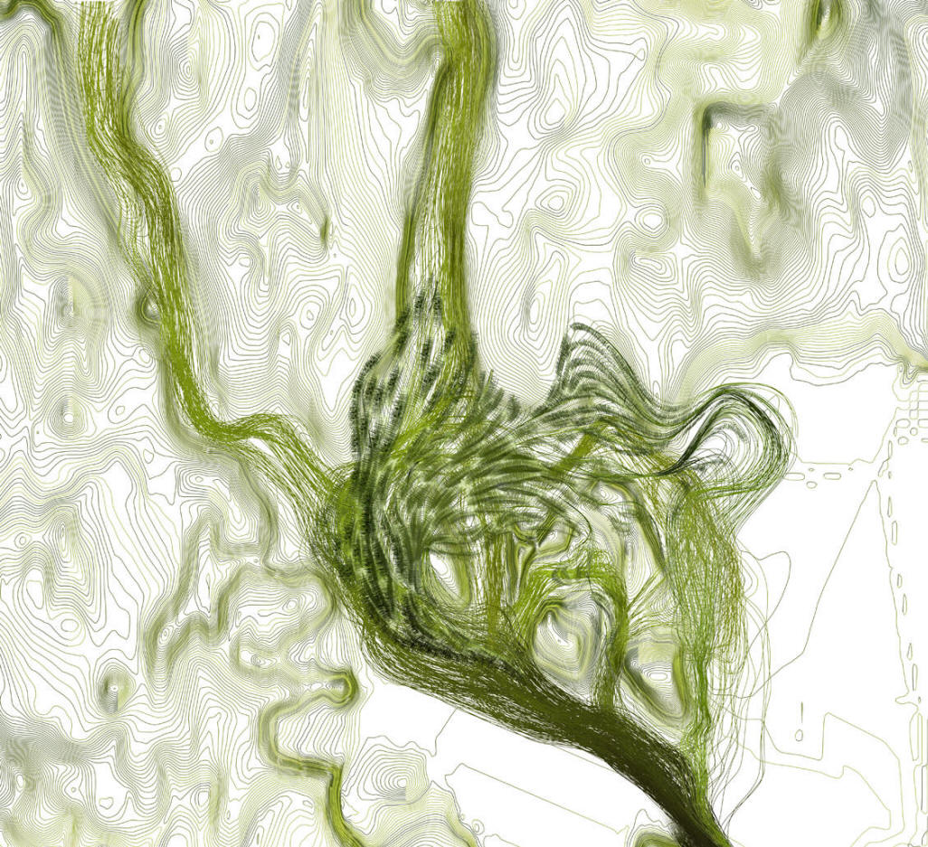
Scaler ZXY Scripts from topographic pressure / Flow Scripts from gravity floading /
--------------------------
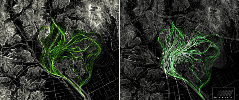
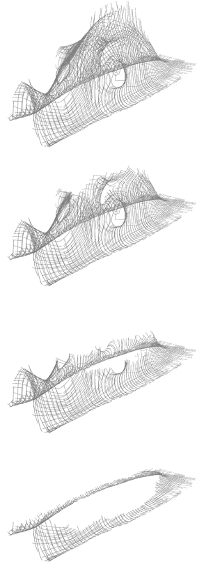
The generative process, Topological Swarm-Town
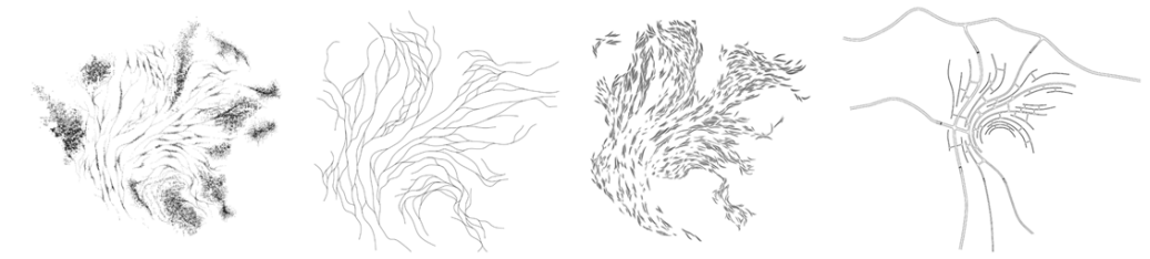
A) FLOW scripts / these drawings are illustrating the gap and evolution between Swarm-Town and a typical Hyppodamos master plan:
-Swarm-Town: the grid is directly impulsed by geographic obstacles as relief and nature. The grid is draw by trajectories, as statistic value of movements, extracting a specific result from each situation.
-Euclidian grid as Hyppodamos Grid: the grid is an abstract and ideal vision of urban planning, using Tabula Rasa as a flatness procedure.
-------------
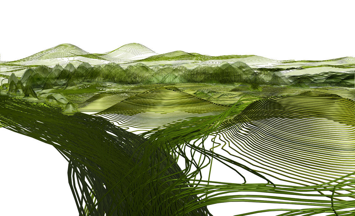
Preliminary geography is the substrate which generates a morphogenetic paths grid, support of the geometric organization of urbanism.
The script links the comportment of particles and trajectories to the topo morphologies of the ground. The tracks curves are reacting and developing their own path through the relief and by consequently preserving the ``Topo`` zones: green and upper level territories.
The wavy, undulating lines generated by the script define the Matrix Grid at the origin of the future development. By their interlaced geometries they are the support of flux and accessibility, construction positioning and all the planning and cartographical organization.
Process
The particles movements are applied on the level of the flat land, filling by a ‘flooding’ effect the tablecloth of the ground.
This script sends virtual particles in a topographic 3d representation and re-read the path way of each of them to create the multiplicity of lines.
The flow network implements a global geometry for:
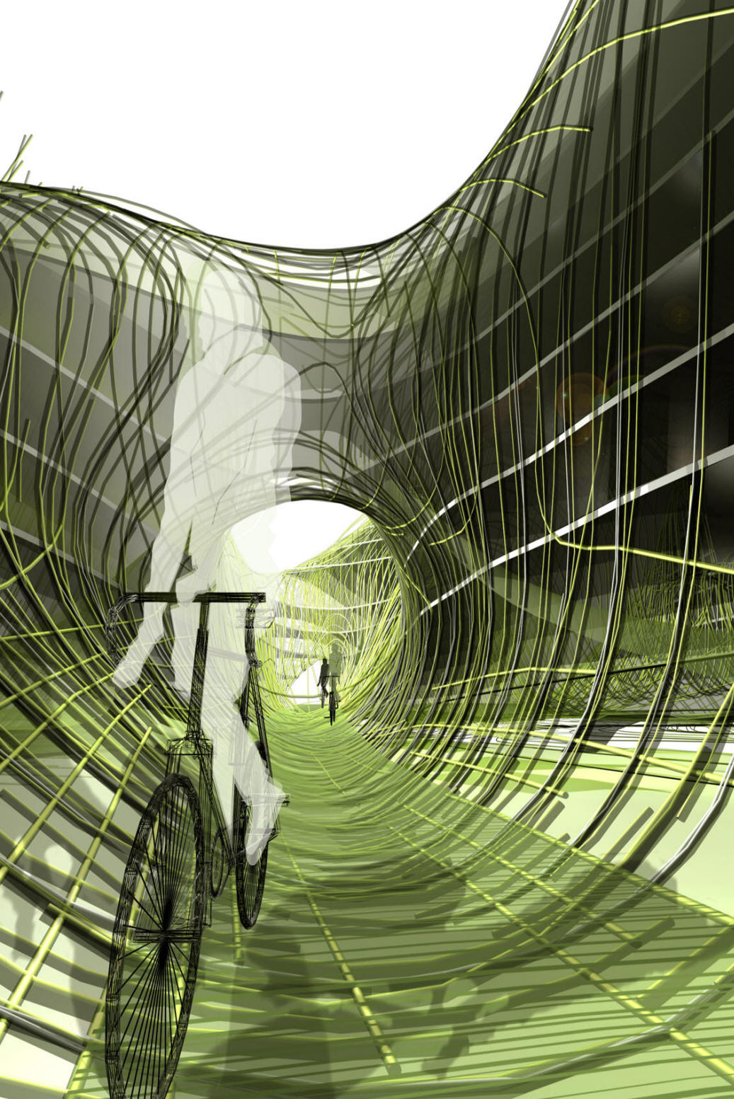
-Access, pedestrian with green mobility network
-Smart Network for Bicycles at the level of the ground infiltrating every part of the planning, crossing the building itself by slop passage through them
-Agriculture fields in the emptiness of the flow tracks
-Urban nature following the pedestrian walkway
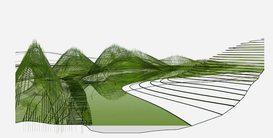
-Underground road, appearing and disappearing on surface. The bottom level of the road network is located on the level of the existing ground height, (compared to the adding of an average height of 5 meters for the future ground height). The new level is released of CO˛ traffic to become the pedestrian, bicycle and smart accessibility level.
1) Grid by trajectories through relief obstacles / Swarm-Town
2) Grid by deformation from relief obstacles
3) Grid by extracting relief obstacles
4) Blind Grid / Euclidian abstraction
------------------------------
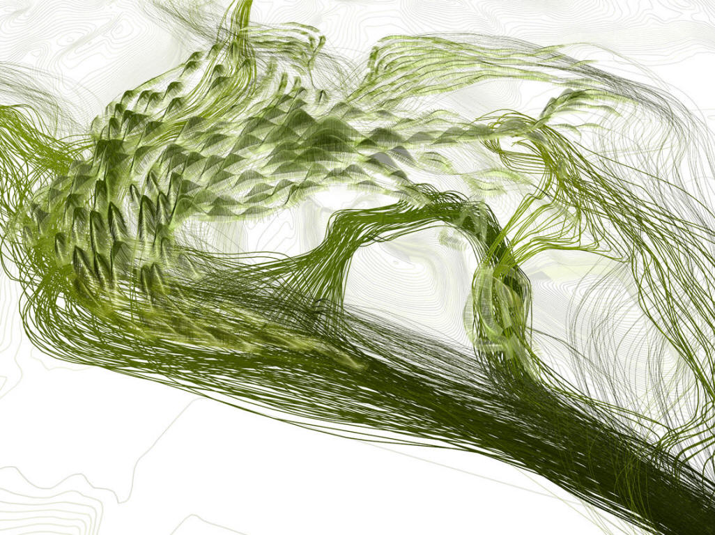
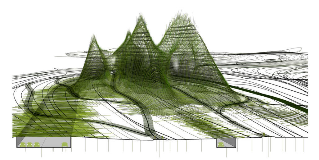
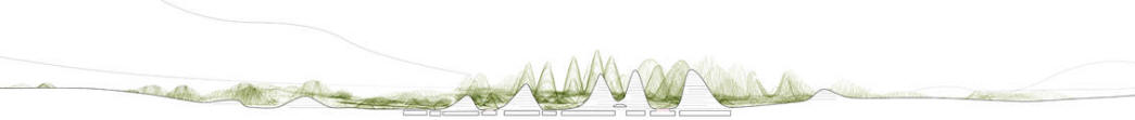
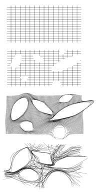
B) ZXY Scaler scripts / pressure effect and emerging result from the topographies relief.
This script implements skyline, urban density and programs.
Buildings are scaled in ZXY direction depending on both parameters
- Volumetric and surfaces requests from the programmatic variables
- Scaling pressure on this emerging geometry from contingent topographies
The both inputs generate hypertrophies and transformations by snapping, gluing, and liming between growing shapes. It’s developing interconnectivity or metamorphosis of their physical relationships.
Process
The program is developed in a flat representation
Those programmatic spectrums are then enrolled on the Path Grid.
This programmatic necklace is transformed by the script in ZXY and re shaped incrementally, according to topographical and volumetric parameters.
As a Venturi effect (the pressure of the wind through an obstacle), the relief is re read by the script as topological pressure and strength to directly deform and adjust the height of all building and emergences.
For example:
-A valley between two existing hill scales up the density, as the increasing of the pressure of the flux
-At the opposite a large and wide territories scale down as a spreading of density
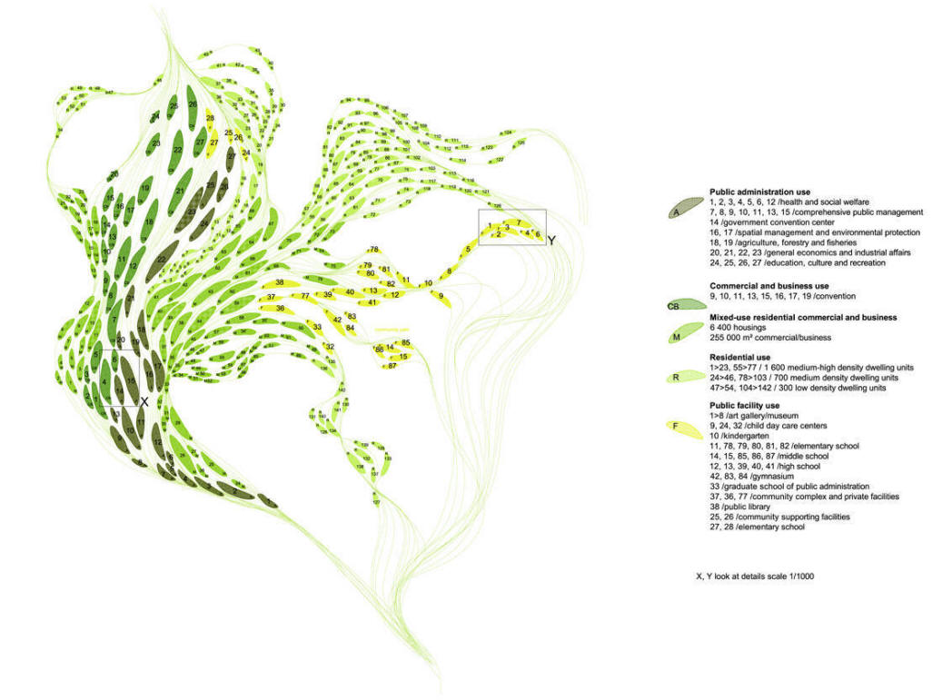
The program of PAT development has been ‘’injected’’ in the scripts by several go and return, by several induction-deduction in a way to adjust the algorithm result to the strategy of planning:
-The Public Administration Use is located in the taller part as an urban vertical City, a Down-Town. The higher building is 25 floors / 80 meters high.
-The Commercial and Business Use is located on the neighborhood of the administration, with direct access from the two main roads.
-The Mixed Use Residential Commercial and Business is located between the core of the Administrative and the Green Area
-The Residential Use zones are located on the boundaries to be directly in connection with the green area and Public Park.
-The Public Facilities is stretched between the Lake and the Center, concentrated on the lake for all leisure, cultural and educational part and spread equally on the city for all other facilities.
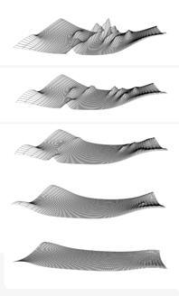
Maximum pressure effect, From Flatness to relief
-----------------------------------
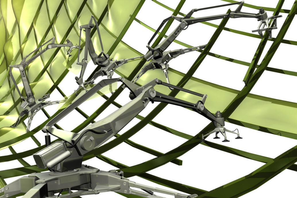
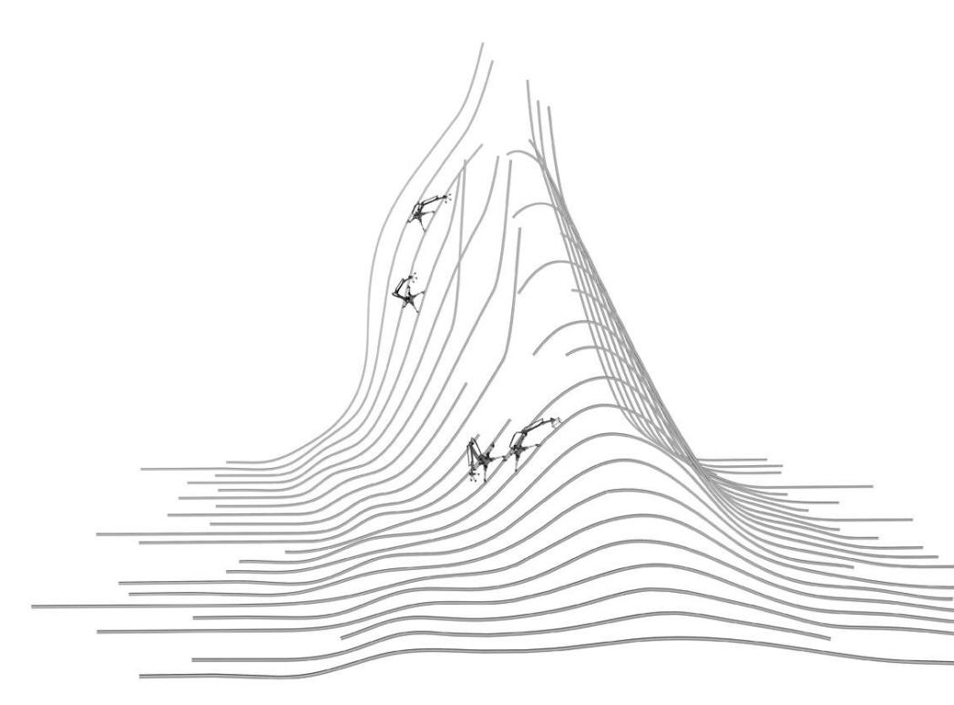
C) Nerves script & Robotic process
The third script is a process which develops the ‘indoor-outdoor interface’ as the structures of envelops of each building, as an adaptable and variable tooling. The algorithm of the pattern is done according to programmatic requirements, shapes, volumes, situation of each building... The Swam-Town involve a process of repetitions and differences, as an ‘’adaptable and variable standardization’’.
The structural strands which compose the wrapping pattern are done in welded steel, bended and curved.
The shape of each volumetry is able to be modified and transformed according to the rule of the guideline (maximum and minimum adjustment from the script shape). The core of each building is designed by different architects, but each Nerves has to follow the guide line (including the adaptative script).
Process
Following the step by step, the Nerves structure is the support of:
-glass for windows
-hydroponics and aeroponics vegetation on the steel strands
-tracks support for the movement of the robot.
The guide line will precise the percent between glass and vegetation. The nearest the building are from the green area, more the ‘’indoor, outdoor interfaces’’ become colonized by artificial nature (nature on artificial ground with vitamin dropped by small water pipe). At the opposite, the more we approach Down Town area (Administrative part), the more architectures use raw and dry materiality
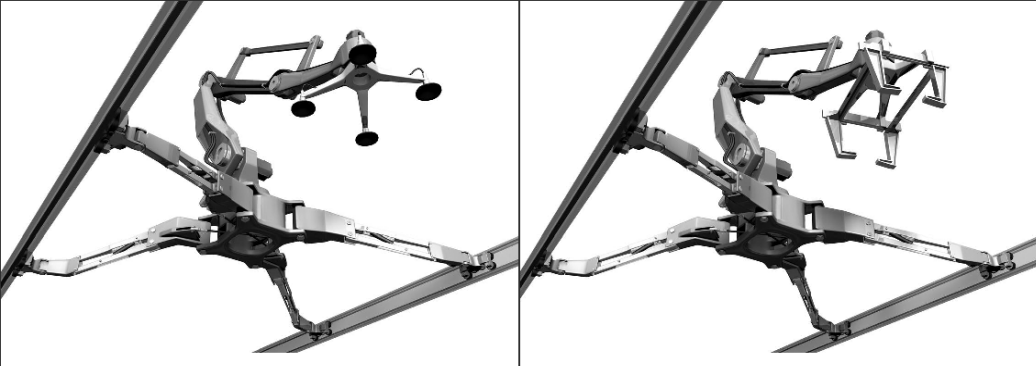
The structural Nerves will be done by machines, designed specifically for this Swarm-Town. Element of adaptability, flexibility and variability, the machine is able to be a crane for steel strands and for glass panel. The ‘’nature’’ of the machine has to be included as a part of the guide line, its comportment, its moving ability, its re-programming… define the frame of the realization of the Nerves. By this way each construction could be modified, transformed time after time with adaptative and transformable envelops.
The design of the machine has been introduced here as a preliminary draft hypothesis.
The software which drives some automatism will integrate several functions:
- Carrying and positioning the steel strand (the welding is done by workers)
- Carrying and positioning the glass panel (the final fixation is also done by workers)
The robot is moving directly on the steel path that it has assembled.
Thus the working process is;
- from the bottom to the top>>>steel profiles
- from the top to the bottom>>>glass panels
The robot will be developed at four levels of definition:
Swam intelligences, Software implementation, Mechanical procedures, Designing shape


Eco-Datas
Self-sufficiency
- Wind turbines on top of in each building.
- Recycling raining water from upper deck of each building
- Photovoltaic cells at substitution of wind turbine (depending on orientation)
- Double façades, including recycling flux and low infra red emission glass to maximize economy of cooling and heating.
- Hypothesis of ground geothermic heating and cooling through the delta of temperature between lake and exterior climate (reverse heating system)
Pollution
- Recycling CO˛ through green area and hydroponics vegetation growing on buildings
- Diminution of the noise pollution by positioning the road on the underground level.
- Decantation chamber for filtrating cars’ pollution within the underground road network
- Low CO˛ emission by developing electric public transports, the bus are the only vehicles than can reach net work stations on ground level.
Flux
- Pedestrian and Bicycle (through city, buildings, and forests)
- Cars’ network on the underground level (outcropping ground level on specific location as an undulating snake). Natural light is introduced by slices opening in the ground level.
- Bus deposits on the upper surface, including modal transportation (bicycles…)
Nature
- Green areas are totally porous, permeable with all the smart network of the Swarm-Town, pedestrians and bicycles flux.
- ‘’Artificial’ Nature (hydroponics, aeroponics) on artificial substrate wrapping some structural stands of the building
- Trees followings the line network of the pedestrian walkways
- Green Interstices, as small-agriculture fields, breeding, vegetable fields, arboretum, in the residuals interstices of the Line Flow. Near the lake green areas belong to marsh biotopes.
Foot prints
- Calculation during the project of global and individual CO˛ footprints.
Our team of engineers will follow and adjust this parameter during all phases of studies.
In case of non neutral CO˛ emission, compensations could be developed.
Swarm-town is the first city which includes at the same time:
- Cities morphologies and skylines generated by existing topographies
- Ecological urban development linked to ethical individual comportment
Biotopes
- Low speed wind by a non linear urban master plan
- Preservation of green areas as a strategy of urban design
- Identification of wild nature (plants and animal species) as a integrated parameter
- Recognition of the specific climate as a generative element
Guide-line
The process of shaping a new building through guide line will follow several steps:
Variability and local adaptability generated by the three scripts
- Distances between buildings (flow script)
- Combination and Snapping of buildings (flow and scaling script)
- Size of buildings, in X-Y-Z (scaling script)
- Façade of building (Nerves script)
Located scripts depending of each building will be transmitted to each architect, each developer to introduce the datas of their own programs and specific requests.
The three scripts include internal parameters which could be modified by each architect as:
- Ratio between X-Y-Z scale
- Façade opening and windows size
- Envelop shape variation within the maximum and minimum gauge (with some algorithmic limitations to keep the global city skyline)
- Materiality of the façade
The next definition of the software in beta and 1.0 version, would clarify and precise all parameters of this guide-line. The team in charge of this will be composed by:
- Architects
- Urban planner specialists (datas analyses, programming development)
- Mathematician and software programming engineers
- Biologist engineers with landscape architects
- Sustainable development engineers (energy, footprint calculation…)
- Structural engineers and robotic engineers
- Network engineers 1 (water, draining, sewage)
- Network engineers 2 (transportation, public and private)
- Light engineers
- Local wild life specialist
- Agriculture specialist
...